 Talking Science Podcast
Clouds – The Biggest Uncertainty in Climate Science
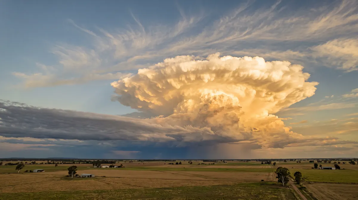
Look out the window on almost any day and there they are: clouds drifting overhead, sometimes wispy and thin, sometimes piled up like mountains, sometimes a flat grey lid stretching from one horizon to the other. They are so familiar that we treat them as scenery rather than something that needs explaining.
Yet clouds are physics in action, and they sit at the centre of one of the biggest open questions in climate science. They cool the planet and warm it at the same time, and working out which effect will win as the world heats up is the single largest source of uncertainty in projections of future warming.
What a Cloud Actually Is
Even air that feels perfectly dry contains water as an invisible gas, water vapour. How much it can hold depends on temperature: warm air holds more than cool air. Cool a parcel of air enough and it reaches saturation, the point where it cannot hold any more. Cool it further and the extra vapour condenses into tiny droplets of liquid water or, if it is cold enough, tiny ice crystals.
A cloud, one stage in the water cycle, is simply a vast collection of those droplets and crystals, so small and light that they stay suspended rather than falling, and numerous enough to scatter sunlight and show up as a white or grey shape in the sky. Fog is exactly the same thing formed at ground level, so walking through a thick fog really is walking through a cloud.
Every Droplet Needs a Seed
Water vapour finds it surprisingly hard to form droplets out of perfectly clean air. It needs something to gather on. Those starting points are called condensation nuclei, and they are essentially dust: sea salt flung up from wave crests, fine soil blown off dry ground, smoke from fires and other microscopic particles. Invisible on their own, they fill the atmosphere in enormous numbers, acting as tiny scaffolds for every cloud you have ever seen.
Rising Air Cools Itself
What cools the air in the first place? Mostly, the act of rising. Air pressure falls with height, so a rising parcel of air expands. Pushing outward uses up some of its internal energy, so it cools without touching anything colder. This is called adiabatic cooling, meaning cooling with no heat exchanged with the surroundings. When the rising air cools to saturation, cloud forms, which is why a field of cumulus often has a strikingly flat base marking the height where that threshold was crossed.
Air gets pushed upward in a few main ways:
- Uneven heating. Sun-warmed patches of ground create buoyant pockets of air that bubble up like small hot-air balloons.
- Mountains. Wind running into high ground has nowhere to go but up, a process called orographic lifting.
- Weather fronts. Where air masses of different temperature meet, one is forced up and over the other.
Why Clouds Look So Different
The recipe is the same everywhere, so the variety comes down to how strongly and how high the air rises, and how stable the surrounding atmosphere is. Gentle, widespread lifting gives flat layers called stratus, from the Latin for spread out, the featureless grey of an overcast day. Strong local updraughts on a hot afternoon give cumulus, from the Latin for a heap: the cotton-wool clouds with flat bases and cauliflower tops. Feed one enough moist, rising air and it can tower into an anvil-topped cumulonimbus thunderstorm. Very high up, where it is always well below freezing, thin streaks of ice crystals form cirrus, from the Latin for a curl of hair. Most other cloud names, like those the Bureau of Meteorology uses, are built by combining these ideas of height, shape and rain.
A Mirror and a Blanket at Once
Clouds help set the planet's energy budget, the balance between sunlight coming in and heat radiated back to space. And they push that balance in two opposite directions at once.
They act as a mirror. Bright, white cloud tops reflect a large share of incoming sunlight back to space before it can warm the surface, which cools the planet. They also act as a blanket, absorbing heat rising from the ground and sending some of it back down, which warms the planet in a way broadly similar to greenhouse gases. Every cloud does both. Which wins depends mostly on height and thickness:
- Low, thick clouds such as stratus are excellent mirrors but poor blankets, because they sit at a temperature not far from the surface. On balance they cool.
- High, thin clouds such as cirrus let most sunlight through but trap heat well, partly because they are so cold that they radiate little to space themselves. On balance they warm.
Human activity adds another twist. Pollution releases fine particles that act as extra condensation nuclei, so clouds can form with more, smaller droplets, which makes them brighter. Satellites sometimes show this vividly as long, bright ship tracks, streaks of brightened cloud running along shipping lanes where exhaust particles have seeded extra droplets.
Why Models Struggle
Climate models divide the atmosphere and oceans into a three-dimensional grid and calculate, cell by cell, how energy, moisture and air move. A cell may be tens of kilometres across, while a single cumulus cloud might be only a kilometre or two wide. No supercomputer can simulate every cloud on Earth individually.
So modellers use parameterisations, simplified rules built from physics and observations that estimate the combined effect of all the clouds likely to be in a grid cell. They are carefully refined, but they are approximations, and different groups make different choices.
That matters because of cloud feedback. As the planet warms, cloud patterns will shift. The open question is whether those shifts will add extra warming or partly offset it. Different models give a genuine spread of answers, and that spread is a large part of why projections of future warming come as a range rather than a single number.
It is worth being precise about what is and is not uncertain. That rising greenhouse gases warm the planet rests on physics understood for well over a century, as explained in Climate Change – The Physics Behind It. How much clouds will add to or subtract from that warming is the part still being worked out. Naming that open question honestly is a sign of careful science, not a reason to doubt the basics.
Narrowing the Range
Uncertainty does not mean nobody is looking. Satellites track cloud cover, height, thickness and type across the whole planet, building long records that models can be tested against. Researchers run extremely detailed simulations of small patches of sky, fine enough to resolve individual clouds. Aircraft and ships carry instruments right into the clouds; Australian research voyages, for instance, have sampled clouds over the Southern Ocean, a region models have long found hard to get right. The range is narrowing, though it has not closed.
So the next time a cloud drifts past and changes shape as you watch, there is more going on than weather. Invisible vapour is condensing onto specks of salt and dust, rising air is chilling itself simply by expanding, and a small piece of a still-unsolved planetary puzzle is floating overhead. It is a remarkable thing to say about something so ordinary that most of us walk past it every day without looking up.