 Talking Science Podcast
El Niño and La Niña – Australia's Boom-and-Bust Rainfall
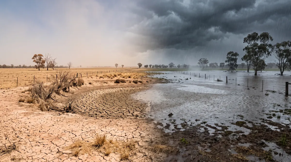
Ask an Australian farmer which years they remember and you will usually hear about extremes. A summer of dust, cracked dams and weeks of total fire bans. Or, a few years later, a summer of relentless rain, swollen rivers and paddocks turned into shallow lakes. You do not need to have lived on the land to carry memories like that.
These swings are not simply runs of luck. A large part of Australia's year-to-year rainfall variability traces back to a slow, recurring pattern in the ocean and air of the tropical Pacific, thousands of kilometres from our coast. It is called the El Niño–Southern Oscillation, or ENSO, and it explains a great deal about drought, flood and fire in this country.
An Ordinary Year in the Pacific
In a typical year, trade winds blow steadily along the equator from east to west, from South America towards Indonesia and Australia. Over such a vast stretch of ocean they drag warm surface water westward, piling it into a deep layer near Indonesia and northern Australia known as the warm pool. Off Peru and Ecuador, the departing water is replaced by colder water rising from the depths, a process called upwelling, so the western Pacific runs a few degrees warmer at the surface than the east.
That difference drives a loop in the atmosphere called the Walker circulation. Warm water near Australia heats the air above it, which rises, cools and drops its moisture as rain. High up, the air travels east, sinks over the cooler eastern Pacific, where sinking air suppresses rain, then flows back west along the surface as the trade winds. Strong trade winds maintain the warm pool, the warm pool keeps air rising over our region, and the loop keeps the winds blowing, one small part of the wider machinery described in our article on ocean currents.
El Niño and La Niña
Sometimes the system weakens. Through ocean-atmosphere interactions that are still not entirely settled, the trade winds slacken and occasionally even briefly reverse. The warm water banked up near Australia sloshes back east, and the rising air and rain follow it towards the central Pacific. For Australia, especially the east and north, El Niño typically means below-average rainfall, a greater chance of drought, and, because dry vegetation and parched soils feed big fires, a higher risk of severe bushfire seasons. It does not guarantee drought anywhere in particular, but it loads the dice.
La Niña is broadly the reverse. The trade winds strengthen, banking even more warm water in the west, and rainfall over northern and eastern Australia intensifies. After a dry spell that can be a blessing for crops and water storages, but it also raises flood risk, especially when La Niña persists for several years in a row.
Forecasters decide these phases by watching sea surface temperatures in a defined patch of the central and eastern tropical Pacific known as the Niño 3.4 region. When it runs warm enough for several months, alongside a matching atmospheric response such as weakened trade winds, agencies including the Bureau of Meteorology declare El Niño; a sustained cooling with matching signs means La Niña. Because both must line up, the in-between neutral state is actually the most common.
A Boy Child and a Seesaw
Generations ago, fishing communities in Peru and Ecuador noticed that every few years, often around Christmas, their cold, nutrient-rich coastal waters turned unusually warm and catches fell. They called it El Niño, Spanish for the boy child, a reference to the Christ child. The Southern Oscillation is the atmospheric half: air pressure at Darwin and at Tahiti tends to move in opposite directions as the cycle progresses, and the difference is tracked as the Southern Oscillation Index, or SOI.
The Indian Ocean Joins In
ENSO is the biggest single driver of Australia's year-to-year climate swings, but not the only one. The Indian Ocean Dipole, or IOD, compares sea temperatures in the western Indian Ocean off East Africa with those near Indonesia and northwest Australia.
- In a positive IOD, the west runs warm and the east cool, generally bringing drier conditions, especially in the southeast.
- In a negative IOD, warmer water sits near our northwest, generally bringing wetter conditions.
The two patterns are separate, but when a positive IOD lines up with El Niño their drying effects can reinforce each other, and a negative IOD with La Niña can compound flood risk.
Drought, Fire and Flood in Living Memory
The Millennium Drought, gripping much of southern and eastern Australia through roughly the 2000s, coincided with a run of El Niño and neutral years and few relieving La Niñas, straining city water supplies and the Murray-Darling Basin. The Black Summer fires of 2019–20 followed a year that combined a strong positive IOD with drought built on earlier dry years. Then an unusual run of three La Niña events from 2020 contributed to repeated, severe flooding in New South Wales and Queensland. None had a single cause, but in each the oceans formed a significant part of the backdrop, a good example of the distinction explored in weather vs climate. ENSO's reach is global too, affecting rain in South America, the South Asian monsoon and Atlantic hurricane activity.
How Far Ahead Can We See?
The Bureau of Meteorology publishes regularly updated ENSO and IOD outlooks, and CSIRO researches the underlying science, including coral and tree-ring records that extend the picture back before modern instruments. Since networks of moored ocean buoys and satellite measurements spread across the tropical Pacific from the 1980s, forecasters can often spot an emerging event several months before its peak, valuable lead time for growers, water authorities and fire agencies. But the limits are real:
- Forecasts are probabilities across broad regions and seasons, not a promise of how much rain a particular town will get.
- There is an autumn predictability barrier, a stretch around the Australian autumn when the Pacific is prone to rapid shifts, making forecasts issued then less reliable.
- The climate is chaotic, so tiny uncertainties grow over months. Forecasters run many simulations from slightly different starting points, known as ensemble forecasting; when they diverge, that spread is itself honest information.
How a warming climate might change ENSO itself is still unsettled. Some research suggests extreme events could become more frequent or intense, but models disagree, and caution is the right stance for now.
A Conversation Across the Ocean
When people recall a decade of drought followed by flood, they are describing the results of a vast, slow exchange between ocean and air far out in the Pacific. It does not explain every dry spell or downpour, and it cannot be forecast perfectly. What it gives Australia is an honest, evidence-based tilt in the odds, sitting usefully between total uncertainty and a certainty nobody could truthfully promise.